


By Jack Phillips
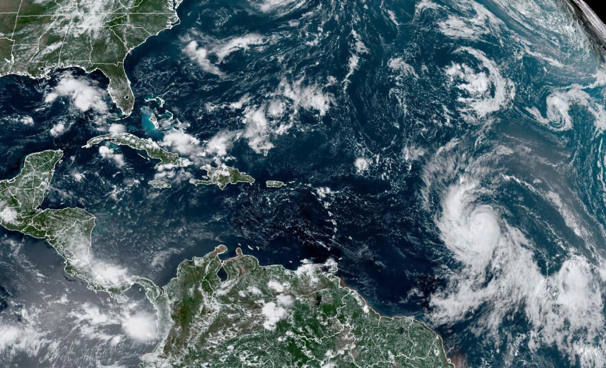
U.S. weather forecasters say that Hurricane Lee has remained a powerful storm as of Friday, although it’s still not clear where the system will head as it churns over the middle of the Atlantic Ocean.
The storm transformed into a Category 5 storm on Friday morning, but by Friday afternoon, it weakened slightly and remained a powerful Category 4 storm with 155 mph winds. A Category 5 storm must have 157 mph or greater winds.
Hurricane Lee is not expected to make landfall, but meteorologists warned it would generate dangerous waves of up to 15 feet across the northern coast of Puerto Rico and other nearby islands. While Lee is on a path that would take it a couple hundred miles northeast of the Caribbean, tropical storm conditions are not forecast for the region.
“Although the hurricane is incredibly powerful, its wind field is not particularly large,” the National Hurricane Center said in an update Friday.
Currently, the storm is located about 500 miles east of the northern Leeward Islands at the far eastern end of the Caribbean Sea. Detailed model plots show that the storm may continue to veer to the west-northwest before tracking directly to the north several hundred miles to the east of the United States, while some forecasts show the storm making landfall somewhere in New England or Atlantic Canadian provinces.
Prediction Models
The National Hurricane Center’s “cone” model only maps out a few days in advance. Its latest update shows the storm remaining a Category 3 hurricane or stronger as it approaches a portion of the Atlantic Ocean north of Puerto Rico, the Dominican Republic, and Haiti, but directly to the east of the Bahamas.
A forecaster with AccuWeather, Bernie Rayno, said that Americans from the upper portion of the mid-Atlantic coast to New England should pay attention to the trajectory of the storm. Parts of Atlantic Canada are most likely to see direct impacts from the storm next week, he said.

“Starting as early as Sunday, seas and surf will build to dangerous levels along the central and northern coast of Florida and expand northward through the mid-Atlantic and New England coasts next week,” AccuWeather’s Joe Lundberg also said.
The storm is expected to strengthen and reach winds of up to 180 mph. Only seven Atlantic hurricanes have had winds of that magnitude since 1966, according to Colorado State University hurricane researcher Phil Klotzbach. Among those was Hurricane Dorian, which pummeled the northern Bahamas in 2019 as a Category 5 storm, hovering over small islands for about two days.
Advertisement – Story continues below
The National Hurricane Center said dangerous surf and rip currents were forecast for most of the U.S. East Coast starting Sunday, but that it did not have further details of what else the storm might unleash.
“It is way too soon to know what level of impacts, if any, Lee might have along the U.S. East Coast, Atlantic Canada or Bermuda late next week,” the center added. “Some fluctuations in intensity are likely over the next few days, however Lee is expected to remain a powerful hurricane through early next week,” it continued
Hurricane Season
Lee is the 12th named storm of the Atlantic hurricane season, which runs from June 1 to Nov. 30 and peaks in September. More than a week ago, Category 3 Hurricane Idalia hit northwestern Florida’s Big Bend region before causing havoc across the southeastern United States.
Days before that, a tropical storm affected Southern California, Nevada, and other western U.S. states, bringing several inches of rain in places that normally don’t get that much in a year. While rare, tropical storms and hurricanes have reached California in the past, including a hurricane that hit San Diego County in October 1858.
This week, Tropical Storm Margot became the 13th named storm after forming on Thursday evening. It was located about 580 miles west-northwest of the Cabo Verde Islands. It had winds of up to 40 mph and was forecast to strengthen into a hurricane over the weekend. It was moving west-northwest at 17 mph and forecasts show that it expected to remain over open water and won’t hit any land.
The National Ocean and Atmospheric Administration in August forecast between 14 and 21 named storms this season, with six to 11 of them expected to become hurricanes, and of those, two to five possibly developing into major hurricanes.
In the Pacific, Hurricane Jova churned through open waters far from Mexico’s southwest coast and posed no threat to land. It was located about 755 miles west-southwest of the southern tip of Baja, California, and was moving west-northwest at 16 mph with winds up to 100 mph.
The Associated Press contributed to this report.